THIS STORY IS NO LONGER BEING UPDATED – RETURN TO YOUR BARRIER TIMES HOMEPAGE FOR THE LATEST
ORIGINAL ARTICLE BELOW

Great Barrier is waking up to the full extent of the damage following a relentless overnight deluge that has left the island’s infrastructure heavily compromised. While the tropical system has begun to move off, leaving behind a mix of sun and clouds, the Aotea Great Barrier Emergency Response Team (ERT) is warning that the danger is far from over.
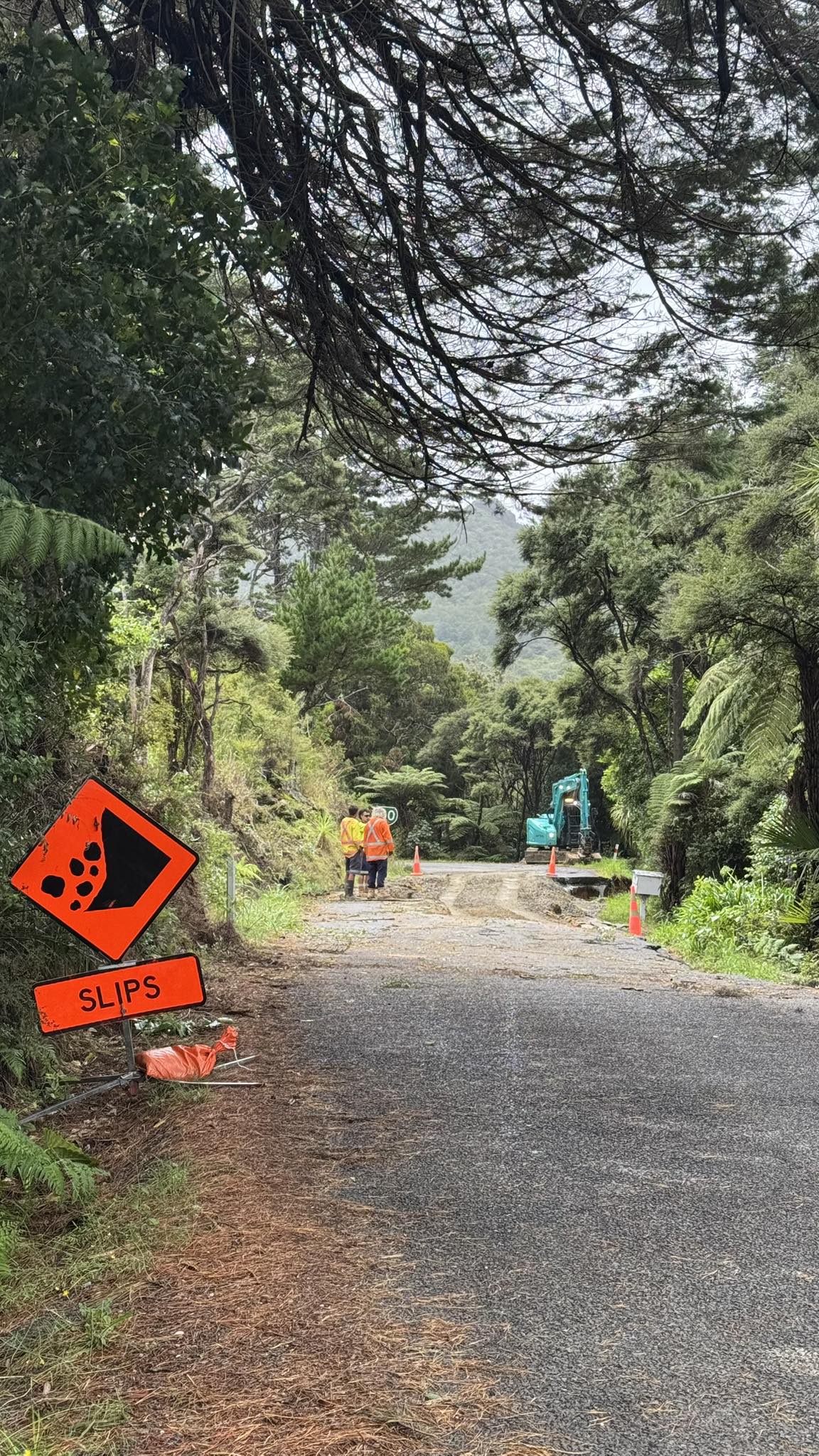
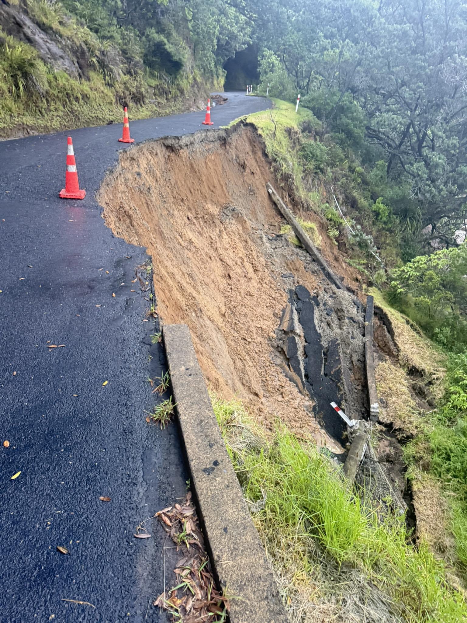
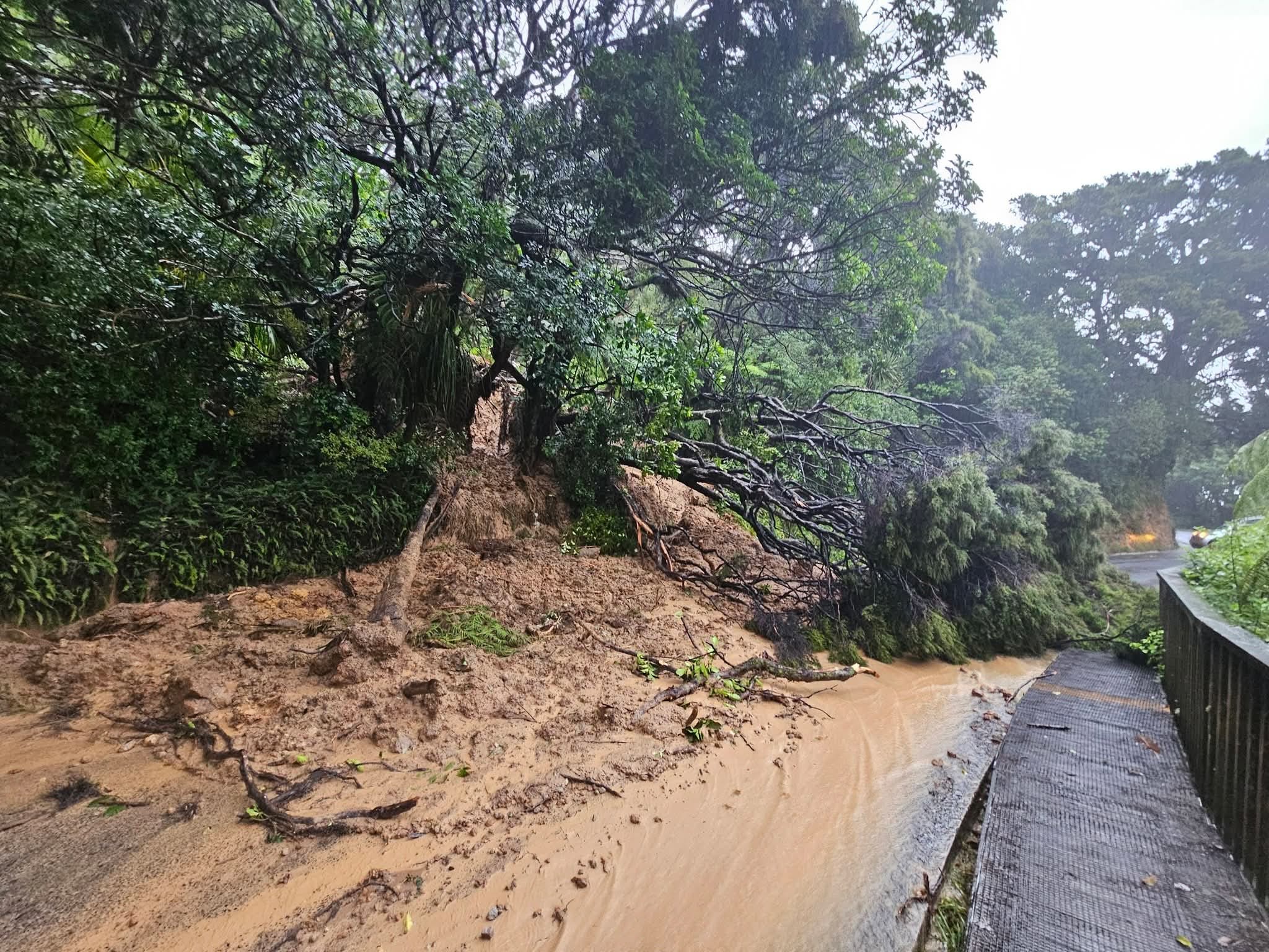
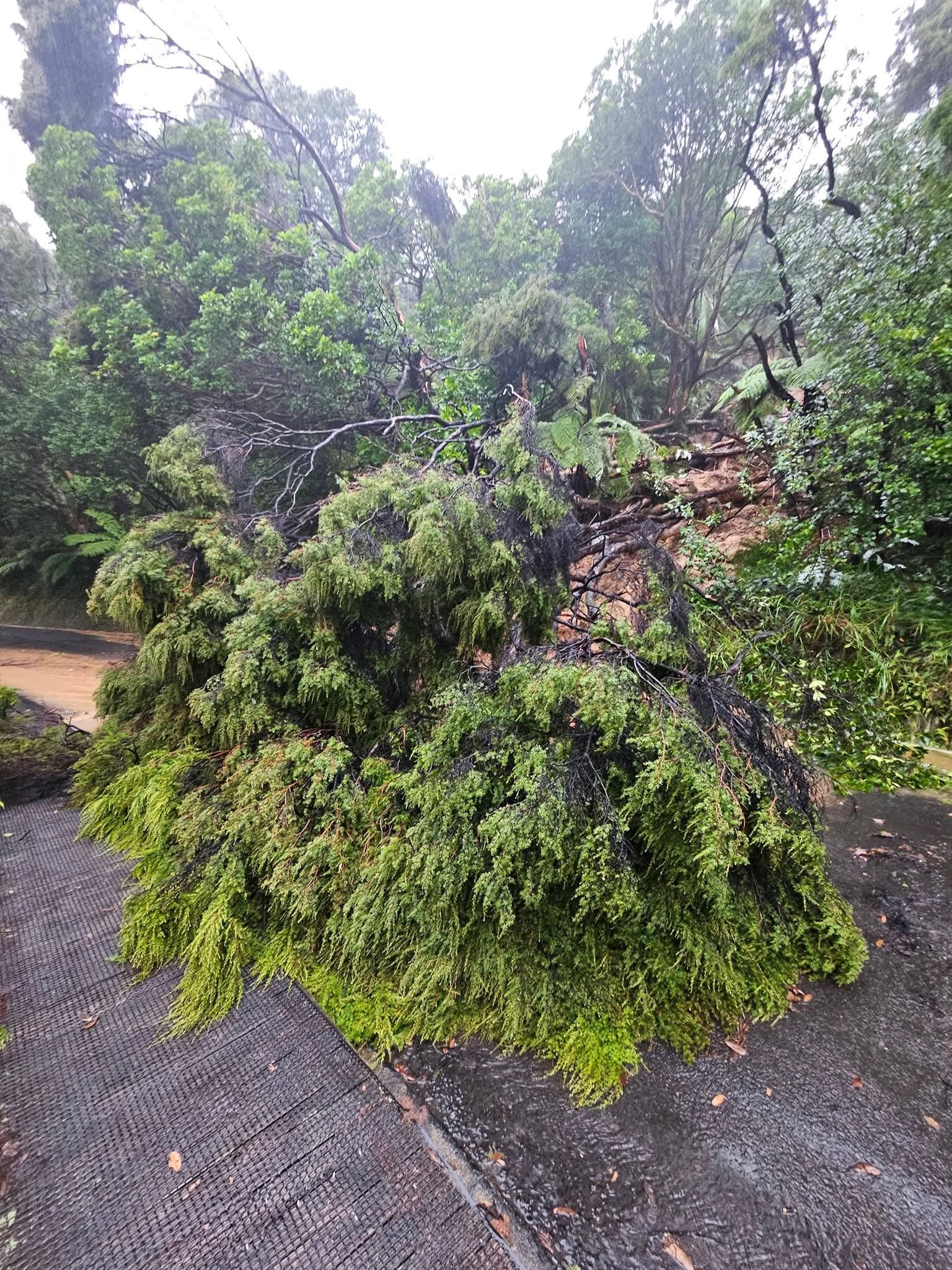
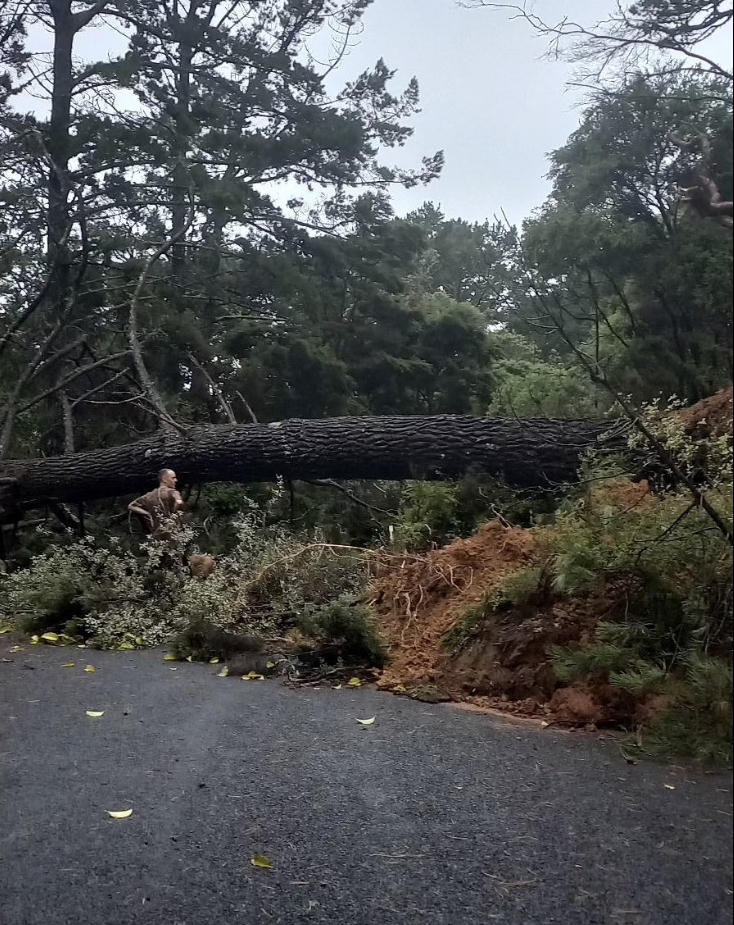
The island’s roading network has been hit hard, with major arteries currently impassable. A significant slip on Okiwi Hill has effectively cut off access to and from the North, while Medland Road remains closed due to a large pine tree blocking the stretch between The Lane and Mitchener Road. In Claris, intense flooding has struck the Auckland Council’s power system, forcing the closure of the Service Centre and Library for the day.
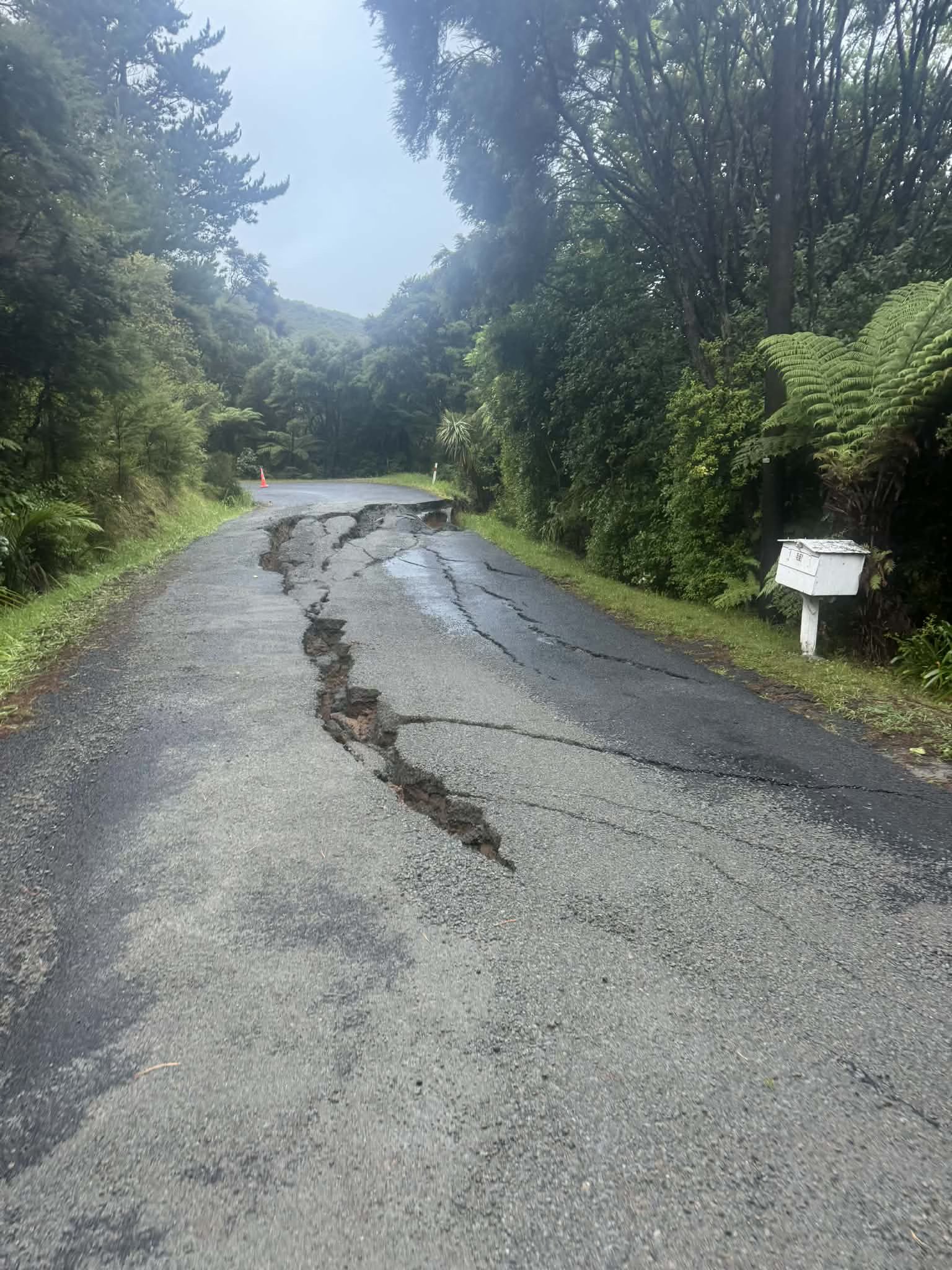
The ERT is urging all residents to stay home if they are in a safe position to do so, as hidden hazards like road surface cracking and unstable shoulders remain a high risk.

Flight Disruptions and Runway Damage
Air travel remains in a state of flux. Barrier Air CEO Grant Bacon confirmed this morning that the runway at Claris Aerodrome sustained damage at the “ocean end” during the storm. The airport is currently operating with a “displaced threshold,” which reduces the usable length of the strip.
“It’s only minor and to be fixed later today,” Bacon said. While the repairs are underway, the airline is prioritising essential supplies. A freighter is currently inbound to the island, but passenger services have been delayed. Barrier Air tentatively expects to resume passenger flights at 2:30 PM, though this is dependent on the completion of the runway repairs and weather conditions remaining stable.
Due to the road damage and blocked access points around the southern end of the island, SeaLink has diverted its Tryphena ferry sailings to Whangaparapara.
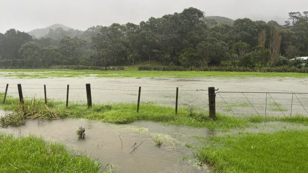
Staggering Rainfall Totals
The scale of the storm is reflected in the extraordinary rainfall totals recorded over the last 48 hours. Claris Airport was hit by a massive 449mm of rain between 6:00 AM on January 20th and 6:00 AM today. The Coromandel Peninsula bore the brunt of the system, with Pauanui recording a staggering 778mm at Sheppard Avenue, the majority of which fell during a torrential 24-hour period on Wednesday. Other notable totals include 328mm in Opua (Northland) and 235mm in Matakana.
As the tropical low heads south-east over the Pacific, it is expected to deepen and become trapped by blocking high pressure. For the upper North Island, this translates to a windy, showery west to south-westerly flow for the next five days, though the extreme deluge rain is not expected to return.
Call for Community Reports
The Emergency Response Team is now in a phase of assessment, working with contractors to summarise the damage across private and commercial properties. Officials are asking residents to assist by providing “eyes on the ground.” If you have photos or reports of slips, flooding, or property damage, please send them via text to 027 257 9482 or email charlotte.mcginity@aucklandcouncil.govt.nz.
This data is critical for the ERT to prioritise repairs and ensure a coordinated response as the cleanup begins in earnest. Residents are reminded to look out for friends and family, and to stay tuned to official channels for further updates as the situation evolves.