Information below is out of date. Click here for the latest developments.
Aotea remains on high alert with a significant weather system continuing to batter the island for at least the next 24 hours. Residents are being urged to stay home and minimize all non-essential travel as heavy rain and gale-force winds make travel risky.

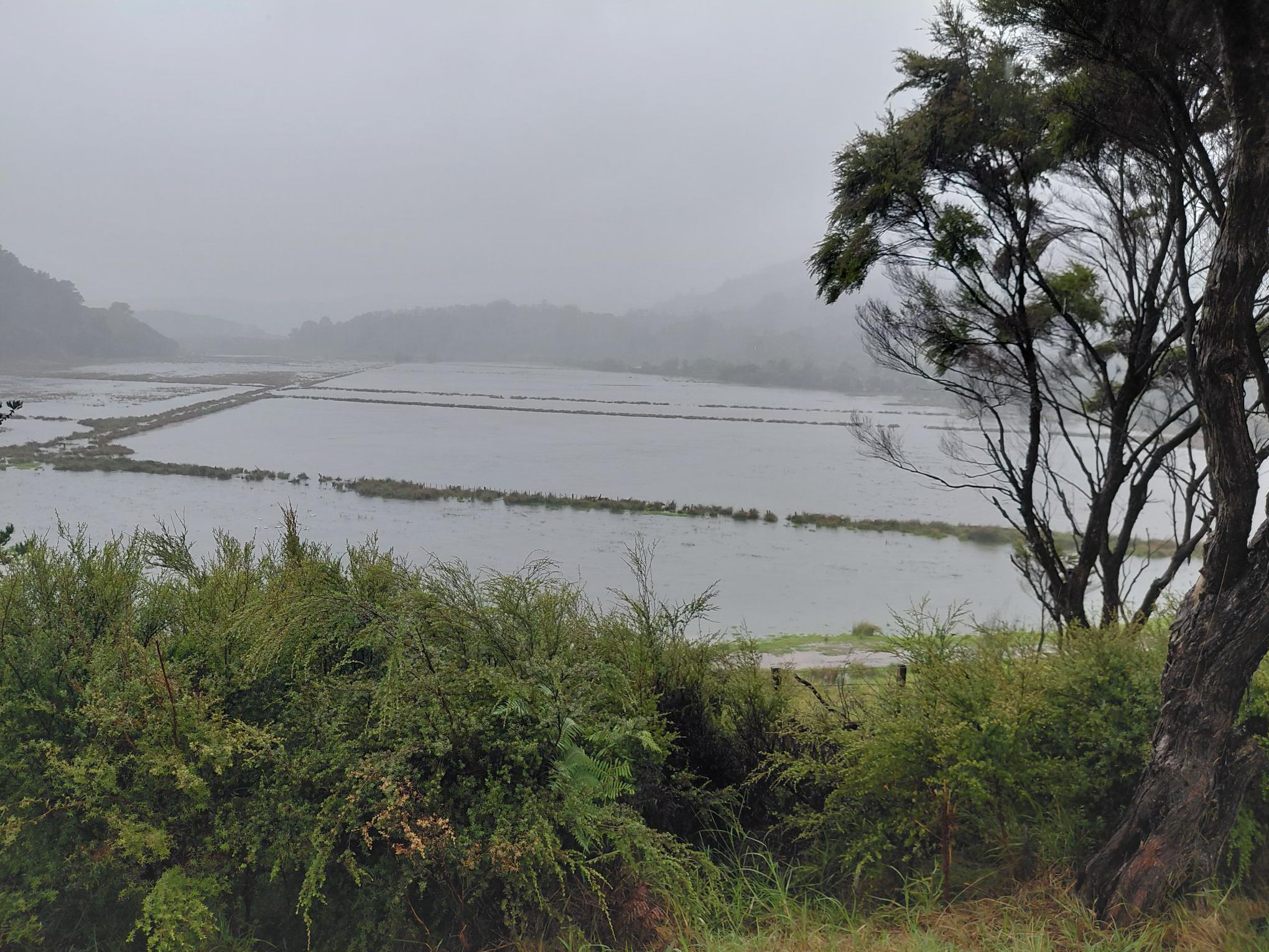
Awana Valley has flooded, with images from this afternoon showing water covering the road. Standard vehicles should not attempt the crossing according to Aotea Great Barrier Emergency Response. Only experienced drivers in four-wheel-drive vehicles should consider it, and even then with extreme caution.
The island’s lifelines to the mainland have been almost entirely severed. SeaLink has confirmed that all ferry sailings for Tuesday, Wednesday, and Thursday have been cancelled. Barrier Air has cancelled the majority of today’s scheduled flights. The local disruptions mirror a broader national trend, with Air New Zealand cancelling several flights across the country due to the worsening conditions.
The National Emergency Management Agency and MetService have placed the island under two separate weather watches. A Heavy Rain Watch is in effect from noon Wednesday through to 3:00 am Thursday. Forecasters warn of intensities reaching 25 to 40 mm, noting there is a high chance this will be upgraded to a full Warning. Simultaneously, a Strong Wind Watch is in place for Wednesday, with easterly gales expected to reach severe levels in exposed areas.
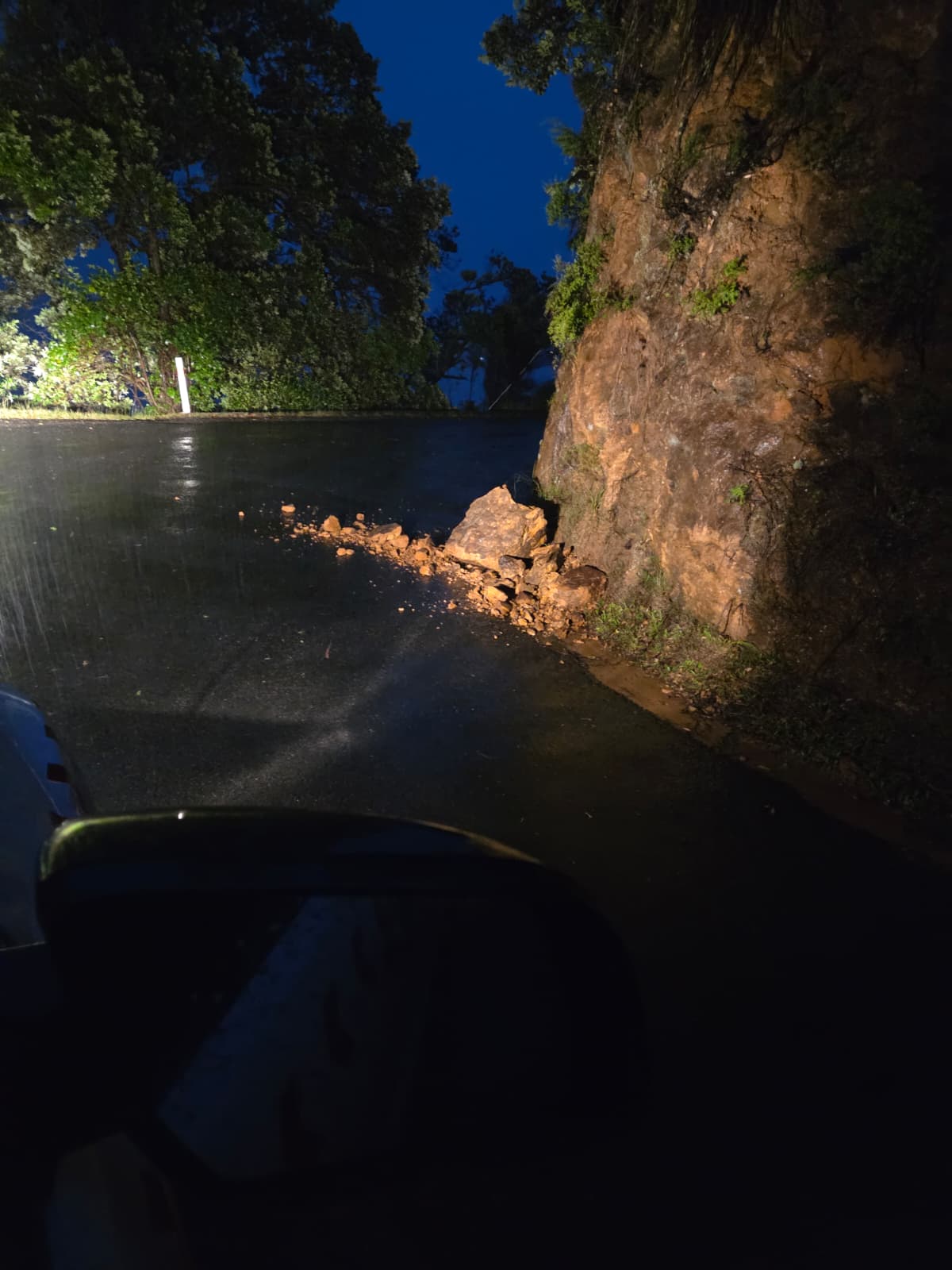
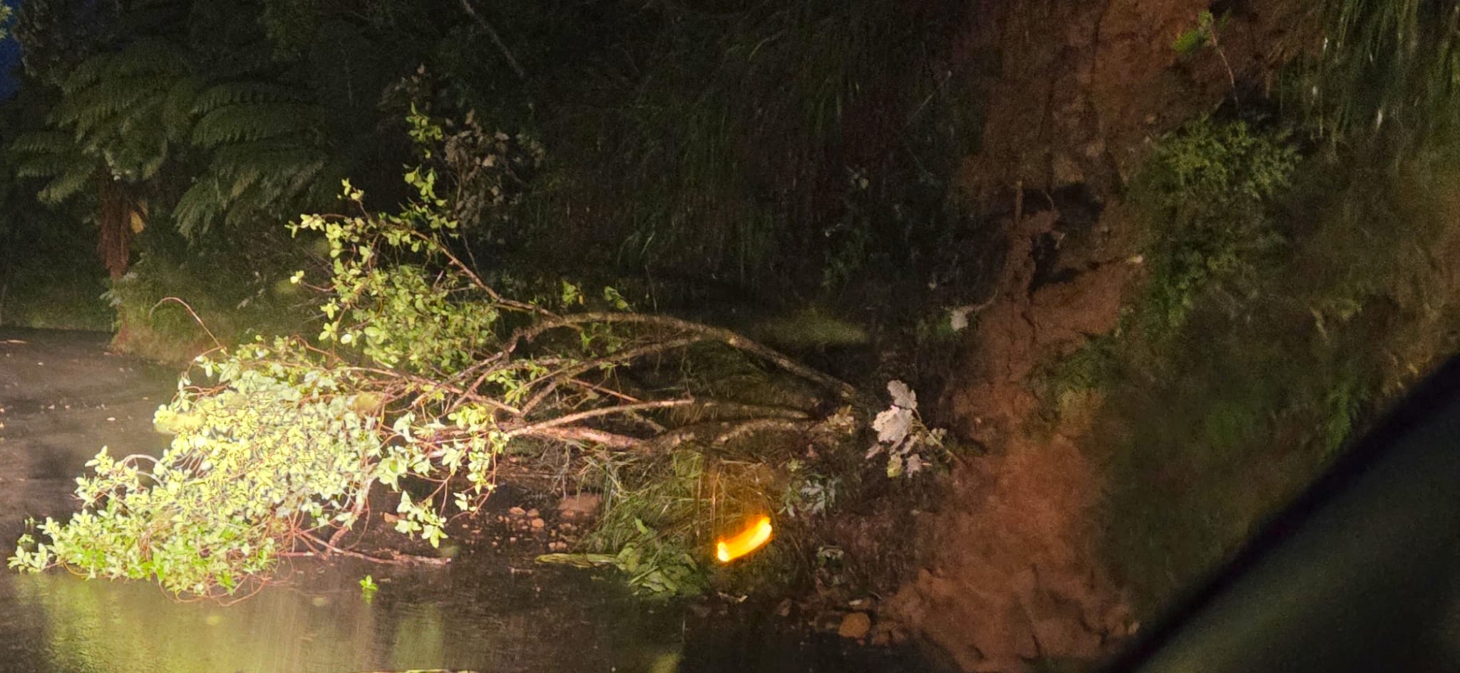
Emergency Response are warning that streams and rivers may rise rapidly, and the risk of surface flooding and slips remains high. Residents are advised to use this evening to clear drains and gutters before the heaviest rain arrives tomorrow afternoon.
There is a glimmer of hope on the horizon, with the forecast suggesting rain may clear to fine weather by Thursday morning. However, with the situation still developing, the Emergency Response Team emphasizes that residents should continue to monitor the forecast closely and prioritize safety above all else.