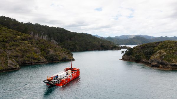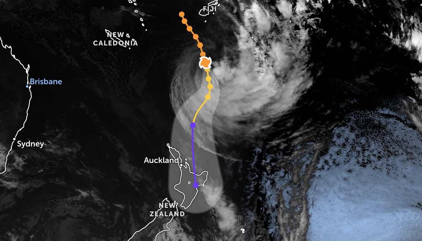
Great Barrier Island is firmly in the crosshairs of Tropical Cyclone Vaianu, with local emergency officials and national leaders warning residents to act now before the system arrives this weekend.
The Aotea Emergency Response Team (ERT) has officially activated following an emergency briefing Wednesday afternoon. While Vaianu is currently outside New Zealand waters, it is expected to reclassify as a Cyclone as it enters our region, with the island likely to feel the brunt of its power on Sunday, April 12.

The Forecast: Wind, Waves, and Coastal Flooding
MetService has placed the entire North Island under a strong wind watch, but the island’s exposed position makes it particularly vulnerable. Winds are expected to build to severe gale force, initially blowing from the east to southeast before swinging southwesterly as the system tracks south.
Cushla Buchanan of the Aotea ERT says the primary focus is Sunday.
“The expectation is that there will be significant and potential damaging winds. While it is too early in the modelling to determine rainfall, this is a fast-moving moist air mass. Expect storm surge and coastal inundation.”

National forecasters are even more blunt. MetService warns that if the cyclone tracks as expected, it will bring “damaging, potentially life-threatening winds” and swells of up to 8 metres beginning early Sunday morning.
Later Could Be Too Late
Nema Director of Civil Defence John Price is urging New Zealanders to trust their instincts rather than waiting for official red warnings.
“If you can, make sure drains around your property are clear of waste and debris, and bring inside or tie down anything that strong winds could break or pick up,” Price said. “Trust your danger sense and don’t wait for official warnings.”
For an island community, the risk of landslides is high. Price noted that landslides are an almost certainty in some areas due to saturated ground. Residents should watch for sticking doors, tilting fences, or water flowing out of slopes.
Local Instructions: How to Prepare
The Aotea ERT has issued the following immediate directives for all island residents:
- Secure Outdoor Items: Tie down or move inside your bins, outdoor furniture, and trampolines.
- Travel: Please avoid all unnecessary travel for Sunday.
- Stay Informed: Monitor MetService alerts and Aotea ERT updates closely.
- Flood Safety: Do not enter floodwaters. As John Price warns, “they are dangerous and can kill you.”
Acting Minister for Emergency Management Chris Penk said that the scale of this storm could be beyond the recent experience coastal and rural communities have recently had.
Prime Minister Christopher Luxon added his weight to the warning today: “It’s important we use the time we’ve got to make sure people are prepared at homes and households.”
The ERT will continue to provide updates as further modelling becomes available. Residents are advised to get prepared before the wind picks up on Saturday night.