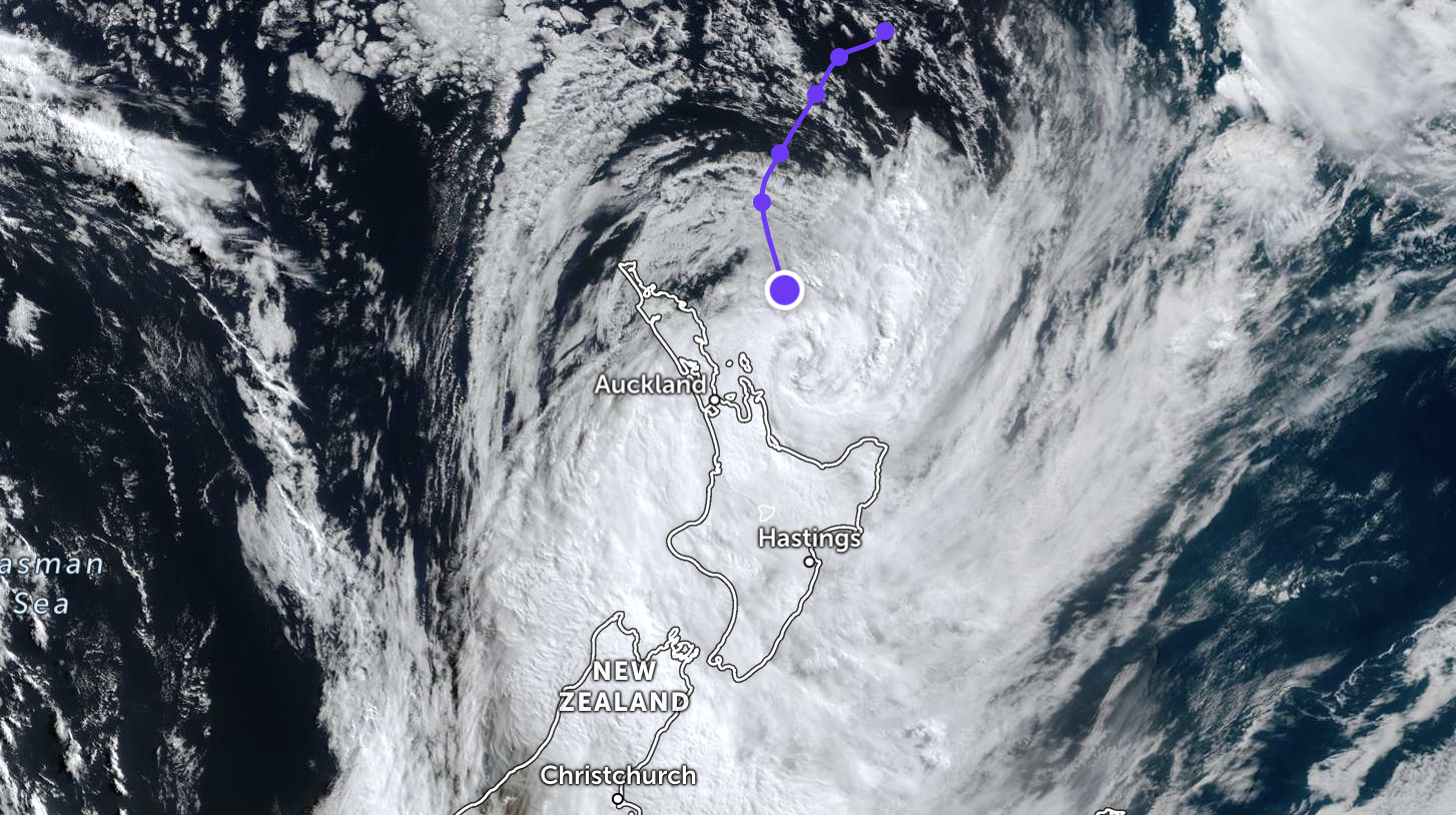
Great Barrier Island has been spared a direct hit from the centre of Cyclone Vaianu, with the system tracking slightly to the east of the island this Sunday morning.
However, severe weather continues to impact the region. As of 10am, south-easterly gusts of up to 100 km/h are crossing the island, which is currently blanketed in dense fog.

Properties on the eastern coastline are taking the brunt of the weather this morning. Forecasters predict this dynamic will shift as the system continues its southward path, bringing a change in wind direction to the western side of the island later today.
MetService meteorologist Braydon White warned that the slight eastward change in the tracking map does not mean the danger has passed.
“This is still a powerful system,” White said. “This is still one that’s going to drop a lot of rain and bring some very strong winds and large swells to the coast.”

While some residents across the wider region have reported lighter winds than anticipated, White cautioned against complacency, describing the current conditions as a false lull before the winds swing.
“That cyclone is just starting to go past Great Barrier at the moment and then once it gets down to the Bay of Plenty is when those southwesterlies will really start to ramp up this afternoon,” he said.
Emergency officials are urging anyone who feels the winds have eased not to venture outside. The incoming southwesterly shift has the potential to bring gusts of up to 130 km/h as the afternoon progresses.
Residents are advised to remain indoors, keep properties secure, and treat the situation as ongoing, until the cyclone has fully cleared the area.