Reproduced with permission from the author Meryle Thomson, Latitudes & Attitudes
Magazine – Yacht Fallado. Subject to copyright in its entirety.
OK, so they may no longer be the home of the America’s Cup, but the waters of New Zealand’s Hauraki Gulf still reign supreme. The offshore waters of New Zealand’s largest city remain what they have always been, a fabulous cruising ground. Spreading out from the area where the Cup was contested, the gulf opens out into a wide blue expanse, dotted with islands just begging to be explored. Some are little more than rocky outcrops, others are so big you could spend weeks exploring them.
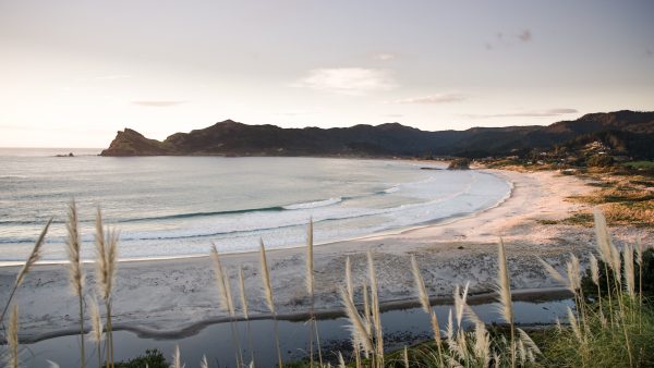
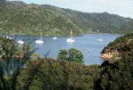
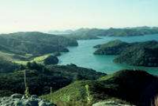
Our favourite cruising area lies right out on the fringes. Ruggedly beautiful Great Barrier Island squats on the outer edge of the Hauraki Gulf, acting (just as Captain James Cook perceived when he so aptly named it) as a “barrier”, protecting the rest of the gulf from the long swells of the open Pacific. But while its windward eastern coastline is ringed by stunning white sand surf beaches, the island’s western shoreline is indented with sheltered harbours.
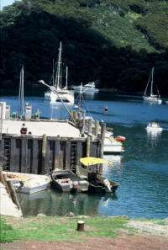
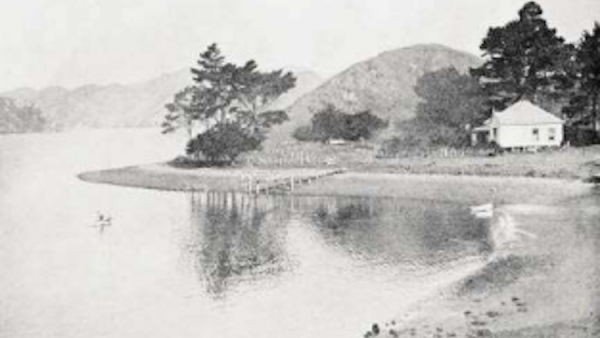
Great Barrier’s most visited harbour is tranquil Port FitzRoy. This harbour is particularly popular with visiting Auckland boaties during the busy Christmas/New Year vacation period. Aside from that peak period, you’ll find it a great cruising destination all year round, with plenty of options for relaxed gunk holing. Kaikoura Island straddles the entrance of the harbour, giving it an almost landlocked aspect. You have the option of entering through the narrow Man of War Passage on the southern edge of Kaikoura, or the wider pass to the north. A number of different arms fan out into the hills behind the protection of Kaikoura Island.
The township of Port FitzRoy (the general store, information centre, a small medical station, the Boating Club and a house or two) are up the slope above the wharf in Rarowharo Bay. A campground and the adjoining headquarters of the Department of Conservation are south of the wharf, tucked in behind Coigne Island.
Almost seventy percent of the island is a nature reserve, under the Government’s Department of Conservation care. The dense vegetation and absence of predators make the island a friendly habitat for some endangered species that have almost disappeared from the mainland. An extensive network of walking tracks maintained by DoC lets you explore the interior, and the various inlets around Port FitzRoy are safe places to leave your boat if you feel the urge to take off exploring.

One of the best walks is to the top of the island’s highest peak. The Mt Hobson (Hirakimata) track starts from Kaiaraara Bay. As you climb, a viewing platform looks out over one of the kauri dams, which was a kind of trip gate used during the period when the island’s majestic kauri trees were logged. As well as a great all-round view of the island when you reach the summit, walking the track will reward you with many sights of natural beauty.
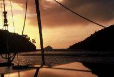
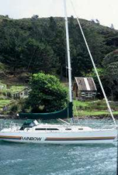
Right at the bottom end of Port FitzRoy is Wairahi Bay. One of the original settler families cleared the land for farming, and it’s still sometimes referred to as Flinn’s Creek or Ghost Bay. There are graves on the shore up towards the head of the bay. Overhanging knarled and twisted pohutukawa trees edge the shoreline with blazing red flowers when they bloom each year around Christmas and into the New Year. Anchoring here and waking up on a sun-drenched morning, gazing across to the smooth hills dotted with white sheep, with not a breath of wind stirring the mirror-like surface of the water around “Fallado’s” hull, is a really magical way to start the day.
Walking ashore here is great too. The hills flanking the bay are now farmed by the Stellin family, so you should ask their permission first. You will find them in the waterfront house, behind a newish jetty with a sign reading “Barrier Gold” above it. The views from the high hill behind the house etch out the whole of FitzRoy harbour and across to neighbouring Little Barrier Island. As well as sheep grazing, Sven Stellin has also branched into the production of Kanuka oil. The leaves from one of New Zealand’s native tea tree species are distilled to produce the highly refined oil. The oil is a valuable product, useful for treating a wide range of illnesses and complaints due to its anti-inflammatory, antibiotic, antiseptic, anti-viral, and antifungal properties. And it’s also a great natural insecticide. Sven will explain the whole process of how he extracts the oil to visitors, and let you sample a selection of the products made from the oil in his rustic gift shop.
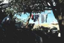
Just before the entrance to Wairahi Bay is Smokehouse Bay. This is perhaps the most visited of all the anchorages in Port FitzRoy. Some years ago, the Webster family established “yachtsmen’s facilities” in the Bay that are available to all visitors. You can fire up the smokehouse and smoke your catch of the day to perfection while enjoying a steaming bath in the full-size tub in the room adjoining it. A freshwater pipe is right alongside, and there are tubs and hand wringers for doing the laundry and a couple of rotary clotheslines to hang it out in the breeze to dry. The picnic tables are a great place to set up a party ashore, and there is a grid and a set of piles for tying up to if you need a hull scrub down between tides. Some cruisers have made Smokehouse their “home away from home,” and base themselves there for weeks at a time. Any wonder, as the charms of this “Robinson Crusoe style” get away from it all place make it a hard place to leave.
But there are other attractive spots to explore. Kiwiriki, or Twin Island Bay, is just opposite, easily identified by the twin islands at its entrance. A picnic area at the head of the bay is accessible by dinghy, and the track behind it links up with the Kaiaraara Bay track. Sitting on anchor here and watching the sun dip below the horizon is an unbeatable way to end the day.
Kaikoura Island, formerly privately owned, is currently being developed as an area for environmental education. Around its shoreline are many little nooks where you can drop your pick and try your luck at catching a fish or two. Snapper is the predominant species targeted by anglers, and some hefty specimens can be hooked in the surrounding waters. The rocky shorelines of the little islets around Wellington Head are good spots to just drift off and dangle a line over the side.
If you are into diving and snorkeling, there are plenty of opportunities too. Visibility is usually excellent, and the abundant sea life offers opportunities for both viewing and collecting. The local crayfish (rock lobster) can be taken all year round (provided you keep to a limit of six per person, and a minimum size limit also applies), and succulent scallops have a season running from mid-July to mid-February. Green-lip mussels, a true kiwi delicacy, are farmed inside Port FitzRoy’s sheltered waters, but they can also be found growing “au naturale” on the rocky shoreline, along with plump rock oysters.
For divers interested in other underwater attractions, there are some good drop-offs and two famous wrecks. The remains of the steamer Wairarapa, one of New Zealand’s worst shipwrecks, lie off the towering cliffs to the east of Miner’s Head, just north of the entrance to Port FitzRoy, while the wreck of the Wiltshire is on the island’s southeast coast.
The run down the coast of the island south of Port FitzRoy is extremely pretty, especially if you take the inside passage. This route threads its way through the Broken Islands group. The largest of the islands is Rangiahua or Flat Island, which has several houses and a jetty with a collection of craft from the Walker (Ngawaka) family, a Maori family who have been in residence for many years. Local legend has it that an earlier resident, Mad Maude Hartnell, who lived in a constant state of drunken warfare with her Scottish husband, would row across to the mainland when the alcohol supplies were dwindling. Quite a feat in an open rowboat!
Make sure you keep an eye out for the bobbing buoys of crayfish pots, especially in the narrow gap between the Junction Island and the mainland. This is the inside passage southern exit, an exciting “hole in the wall” that at first seems impossible to pass between, but when lined up properly, is wide enough for two average-size boats to pass safely. Immediately behind the pass is the anchorage known as Bowling Alley Bay. It’s another good spot for fishing and diving. If the wind starts getting strong, though, it can become rough as a venturi wind can sweep down from the head of the valley that backs the anchorage.
If you elect to pass on the outside of the islands, you will get to see the large gannet colony. The outer headland of Anvil (Mahuki) Island is literally swarming with squawking seabirds. The Australasian gannet breeds in New Zealand, then the young birds spend up to seven years in Australian waters before returning to New Zealand to breed. It’s estimated the headland is home to 2,500 pairs of gannets, and like other colonies around New Zealand, is still growing.
Exiting Port FitzRoy to head north will bring you first into Port Abercrombie, which has two good anchorages. Nagle Cove is tucked into the northwestern corner. There is a farm with a jetty in one corner. Way back in the 1840’s several large ships were built in the cove. One, the barque Stirlingshire, held the record of being the largest built in New Zealand. To the east, Karaka Bay is more open but has a lovely view out to sea. The run further northwards, hugging the coastline, is in the shadow of high cliffs. Right at the northern extremity of the island are “The Needles,” jagged rocky pinnacles that look spectacular.
There is also another very special harbour on Great Barrier’s western shore, but a description of that will fill another whole article, so stay tuned!
Neither the photos nor the text may be reproduced in any form of advertising, marketing, newspaper, brochure, leaflet, magazine, other websites, or on television without permission from Latitudes & Attitudes Magazine.